Blanton Blogs
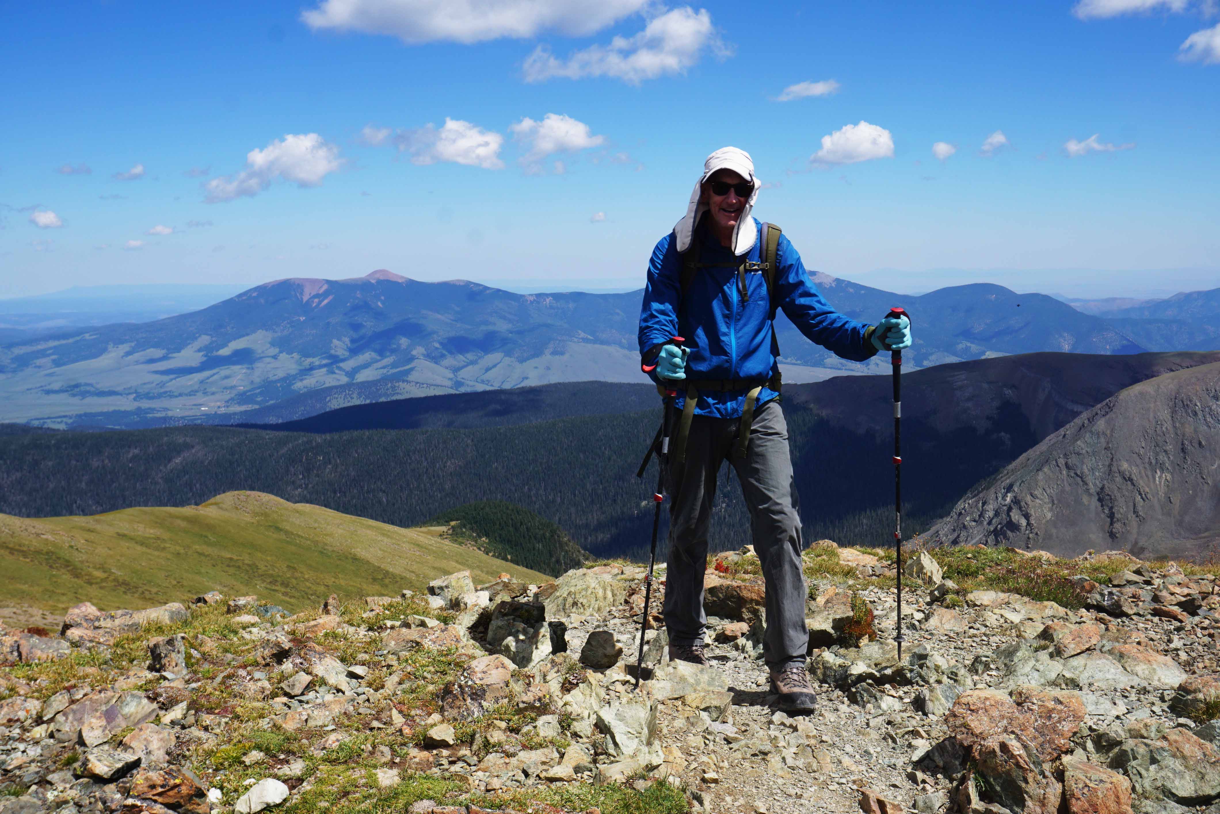
Tour of the Heart of Rocky Mountain National Park
6 Day Backpacking Trip
Rocky Mountain National Park: 6-Day, 56-mile, 13,000 feet of climbing, Backpacking Trip that starts and ends near Grand Lake in Rocky Mountain National Park- follows two sections of the Continental Divide Trail (CDT) and includes summit of Longs Peak (14, 259 feet).
Friday September 6, 2024: Drive to Grand Lake, Rocky Mountain National Park ( pick up backcountry permit) and set up camp at Timber Creek Campground. https://www.nps.gov/romo/index.htm
https://www.nps.gov/romo/planyourvisit/upload/campsite_map.pdf
Attendees: Michael P. Blanton, Henry L. Blanton, Curt Pfarr (PLF SOM EL Paso, TX), and Bob Bubar
Day 1: Backpack 10 miles along North Inlet Trail to July backcountry site.
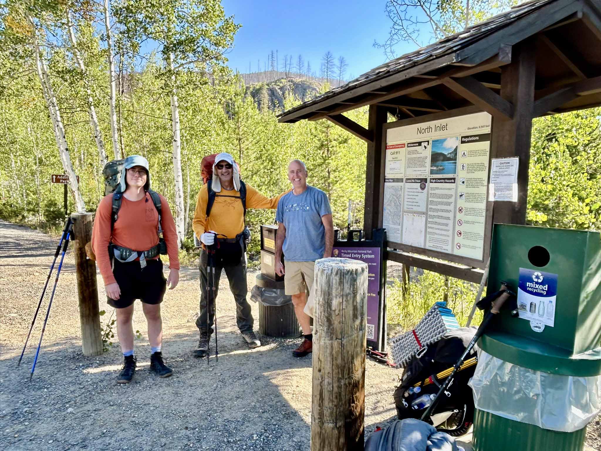 Note: see obligatory trailhead group photo. Perfect weather (high 60’s) and just the
start of fall color appearing- Aspens turning ‘Gold’
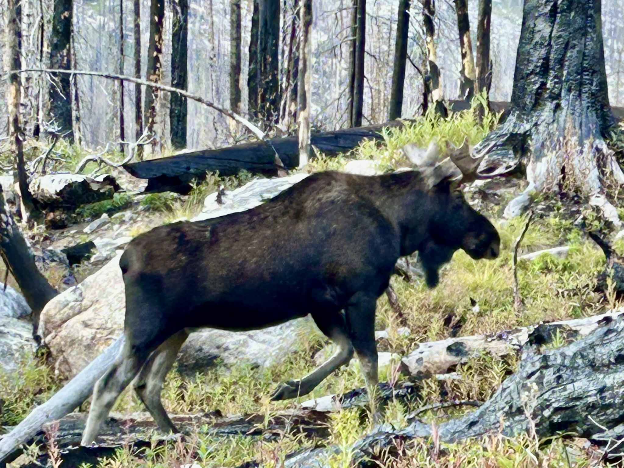
Day 2: Backpack 13 miles along North Inlet to Flattop Mountain to Bear Lake to Glacier Creek to North Longs Peak Trails to Boulder Brook campsite.
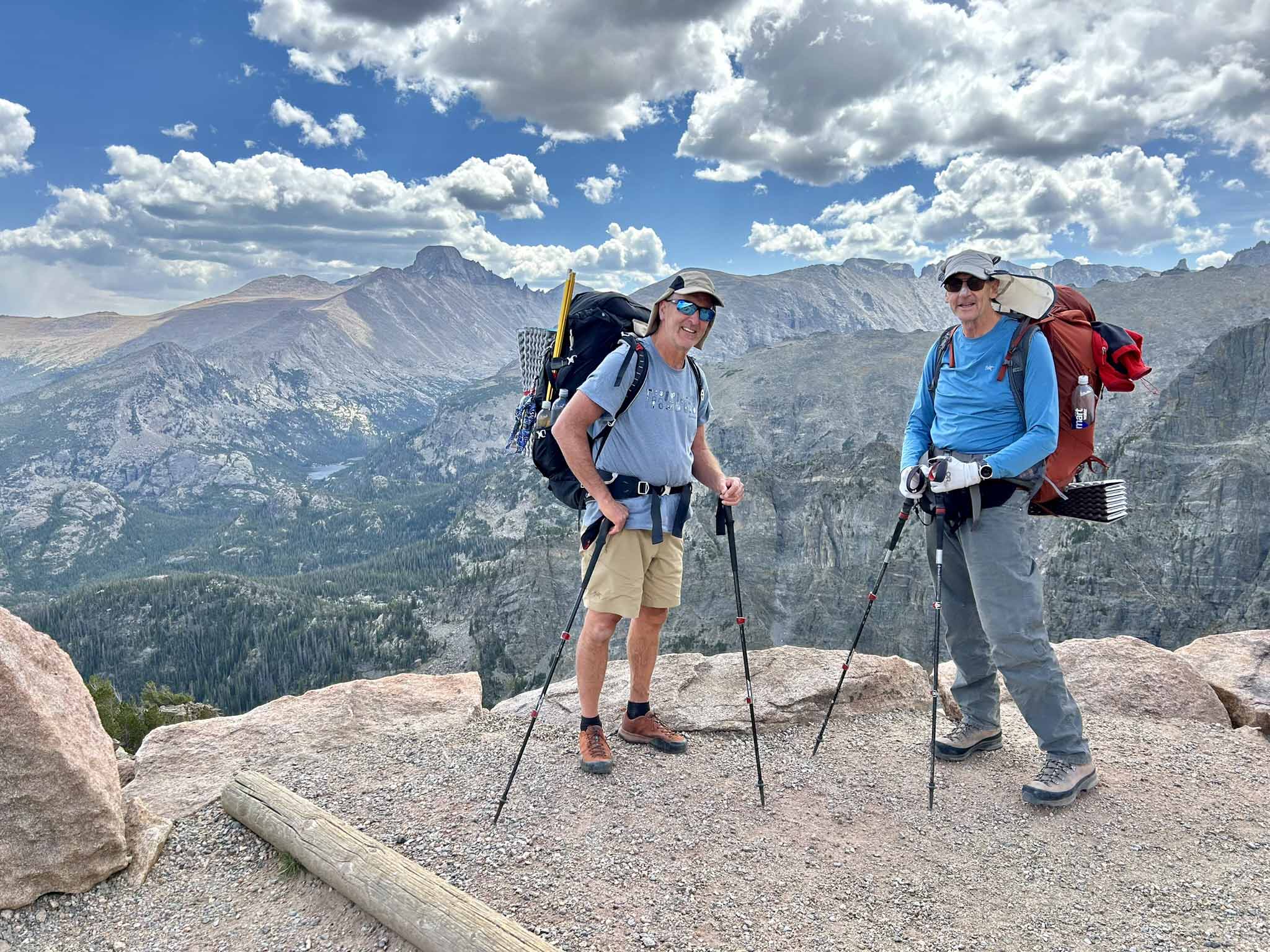 Note: This was a long day! Over the course of 13 miles we ascended over 3,700 feet
that took us up on over Flattop Mountain (12, 500 feet), past Tyndall Glacier before
descending down to Bear Lake and then back up to Boulder Brook Campsite. Just as
we were settling into our campsite- a moose ran thru the campsite.
Day 3: Backpack 5 miles along North Longs Peak Trail to Boulder Field Campsite.
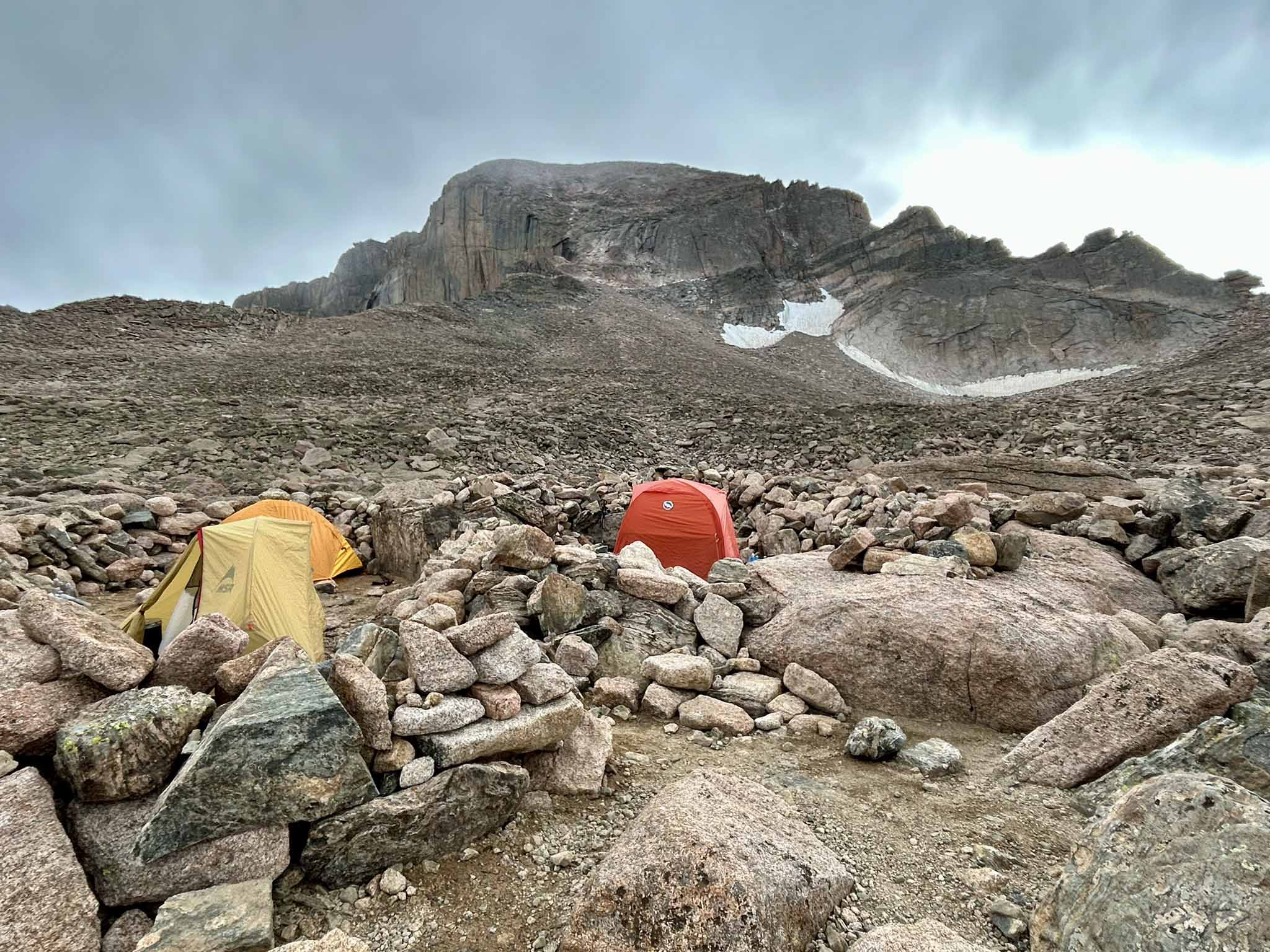 Note: Easy day (ha ha)- we only had to ascend 2,000 feet to our campsite, Boulder
Field located at the base (12, 700 feet) of Long’s Peak. We shared our campsite with
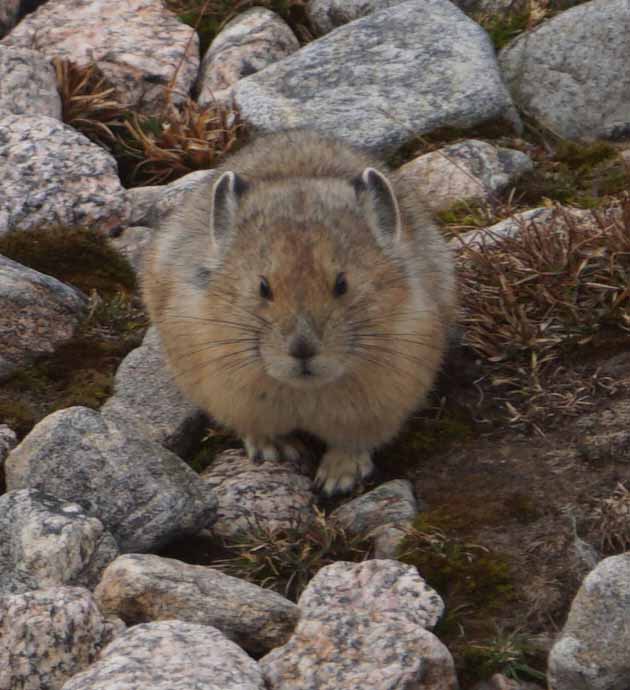
the Pika’s – which may be the cutest animal on Earth.
Day 4: Day hike to summit of Long’s Peak (elevation 14,259 feet); break camp and backpack 5 miles to Boulder Brook Campsite.
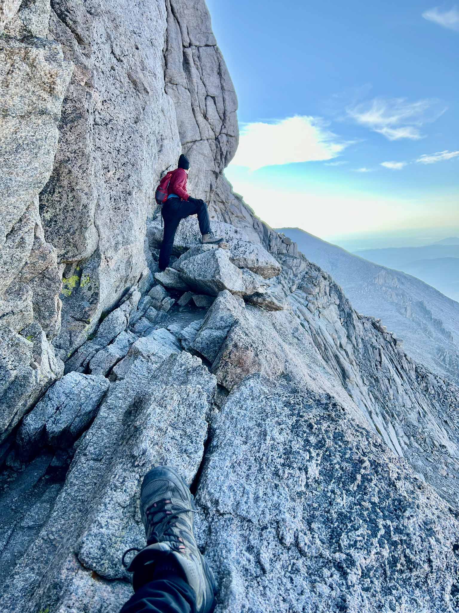 Note: 5 A.M. start - Ascending Long’s Peak (14, 259 feet) was the 2nd scariest thing
I have done in my life (the cables up Half Dome in Yosemite is No. 1). Not sure what
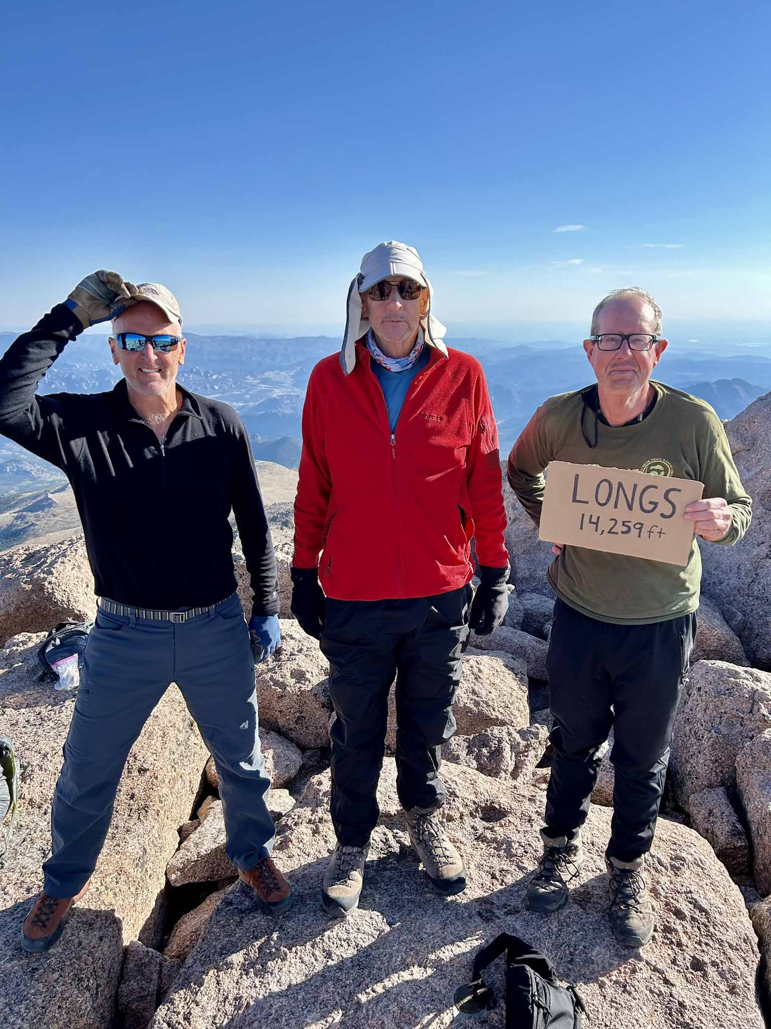
was more scary the Narrows or the Homestretch. As we posed for pictures at the summit
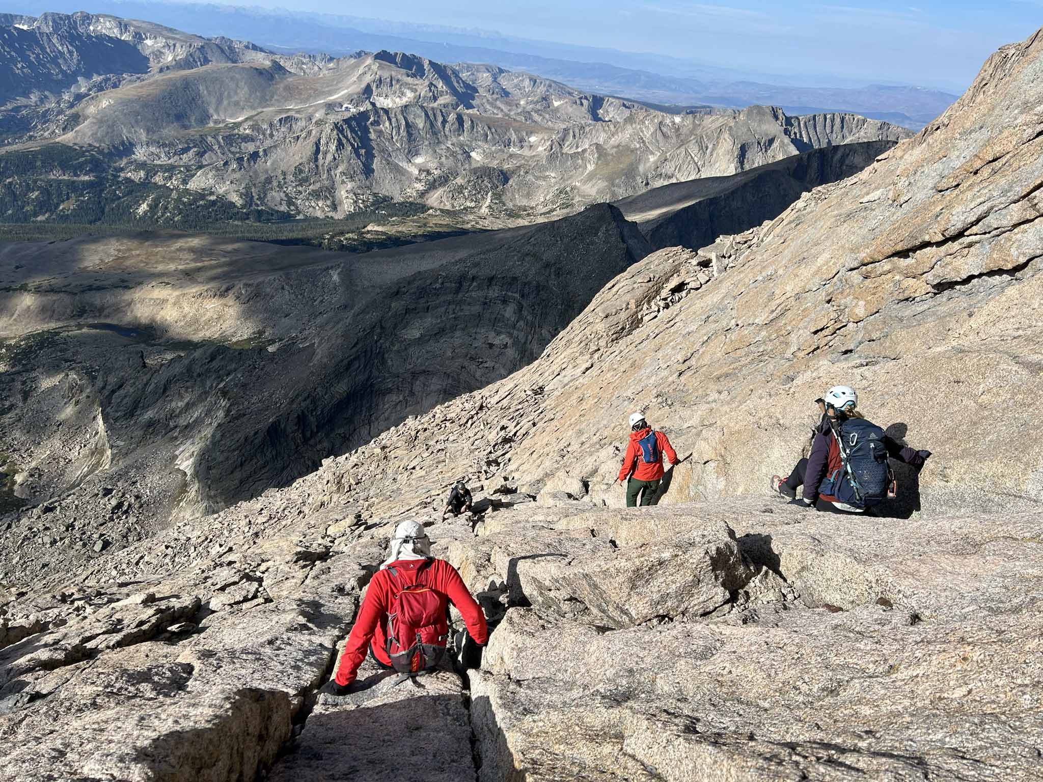
ever present in my mind was the dread of how will I make it down! On your butt was
the answer! .
Day 5: Backpack 13 miles along North Longs Peak to Glacier to Bear Lake to Flattop Mountain to Tonahutu Trails to Timberline Group Campsite.
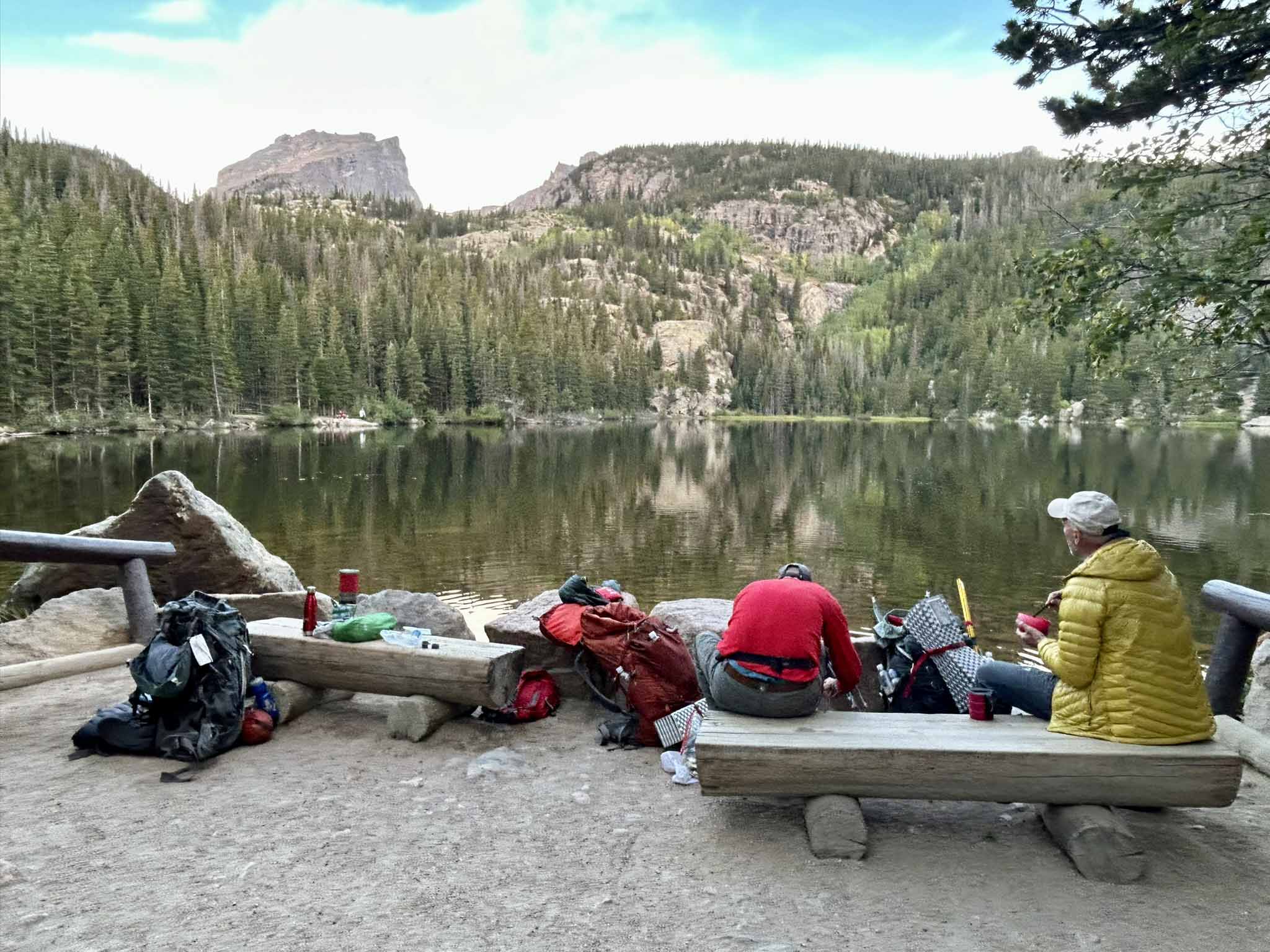 Note: 4 A.M. start – early start since we wanted to get back over Flattop Mountain
before the routine afternoon thunderstorms started. We made a breakfast stop at Bear
Lake (~ 7 A.M.) and made good time up the mountain (image 9690). Last night on the
trail- I finished the last of the Jamaican Rum in my flask!
Day 6: Backpack 10 miles on Tonahutu Trail back to TH. Camp at Timber Creek Campground.
 Note: 10 miles mostly downhill! We met a few friends along the way. By 1 P.M. we
were enjoying beer and burgers (real food) in Grand Lake.
Day 7: Return to Lubbock, TX.
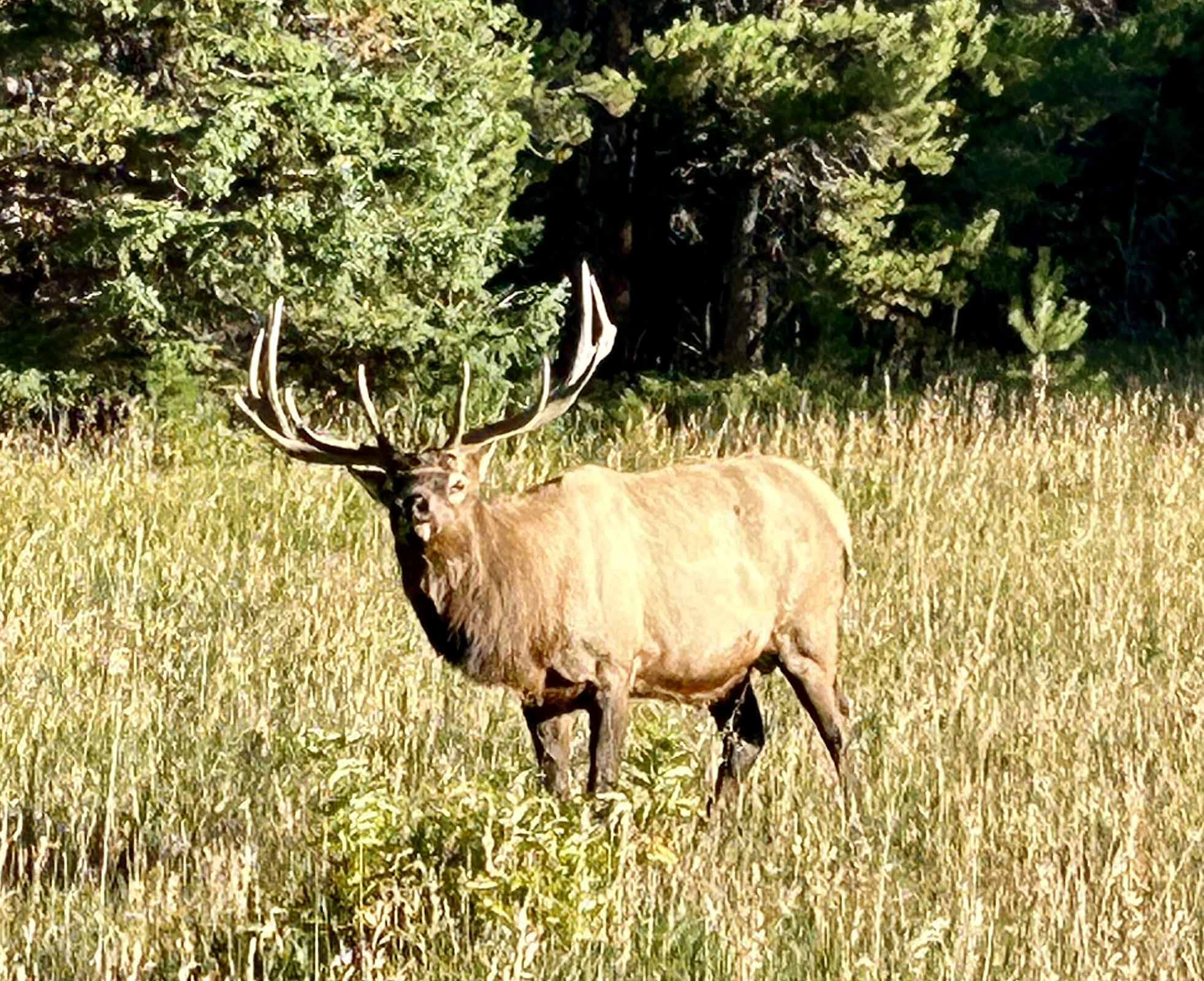 Note: 6 A.M. as I was brewing my morning coffee I could hear the Elk bugling. just
a few hundred feet away. As I took the ridge road back across the park to Estes Park
I noticed the Fall Color was really starting to appear ….. then it was 10 more hours
driving back to Lubbock, TX.
Past Hikes:
Welcome to the latest installment in the Blanton Hiking/Backpacking Log for 2024: Hiking and Mushroom Collecting in the Pecos Wilderness of New Mexico
Day 1: Saturday July 27, 2024: 8 AM (CST) - Three of us (Lenka Halamkova, Mike Blanton, Cornelia De Riese) left Lubbock and drove to Penasco, New Mexico for lunch at Sugar Nymphs (image 9407) and then on to Santa Barbara Campground in the Carson National Forest- gateway to the Pecos Wilderness. https://www.fs.usda.gov/detail/santafe/specialplaces/?cid=fsbdev7_021062.
We were then joined by Igor Ponomarev and Olga Ponomareva.
After setting up camp ( site 009, elevation 8,900 feet) … we did a causal hike along the West Fork Trail #25 for about 5 miles (image 9415). We then enjoyed a campfire and homemade soup (Olga and Igor) and grilled Wild Boar Sausage (fathers day gift to me from my daughter).. and Two Docs beer! (image 9420 and 9421)
Day 2: 6 AM- Breakfast and Coffee (image 9422) and then we were off- group photo at TH to Indian Creek Trail #27 (image 9426).. I waded across the creek while the rest of the group found a location to avoid getting your feet wet (image 9428). As we ascended Indian Canyon we stopped occasionally to rest and/or for Igor to collect mushrooms (image 9429, 9431). After ~ 2 hours Igor and Olga turned around so they could make it back to Lubbock by late afternoon.
The rest of us (Mike, Olga, and Cornelia) continued our ascent that was slowed considerably by fallen trees- we reached the Crest Trail #36 (~12,000 feet around noon. As we followed the Crest Trail we reached a clearing with a magnificent view of Jicarita Peak (image 9435). The final ascent of Jicarita Peak (image 9439) was a rock scramble …. But the view from the summit of Jicarita Peak (elevation 12, 835 feet) was stunning- the whole Santa Barbara basin and divide and Truchas peaks lay before us (image 9444). As we enjoyed snacks in a rock shelter on the summit (image 4055) the wind whipped by us- soon it was time to continue on our journey (image 9448)..we continued south along the Crest Trail #36 for a couple more miles until we reached the junction with Serpent Creek Trail #19 (image 9448). While navigating fallen trees had delayed our progress by ~2 hours at this point, we were still on track to finish our 20 mile loop hike well before sunset, the rest of the hike was downhill, and the start of the Serpent Creek Trail looked very promising… as you can guess that soon ended!... as we descended down to the tree line…the trail all but disappeared, covered with fallen trees… we spent the next 3 hours slowly making progress as we checked the Garmin and All trails apps to navigate. We reached the junction with the East Fork Trail #26 around 7:30 P.M. and we still had 7 more miles back to camp. Fortunately the trail was in excellent shape (translation- only an occasional fallen tree) and so we spent the next two hours trying to cover as much ground as possible before total darkness descended on us. With one headlamp- we traversed the final miles in darkness …. We finally reached camp at 11:40 P.M.(16 hours, 24 minutes). Exhausted- we all quickly crawled into our sleeping bags as I remarked- I’m turning off my 6 A.M. wakeup alarm!
Day 3: ~ 7 A.M. The call of nature and the need for coffee forced me out of my sleeping bag … we enjoyed a morning fire and coffee as we discussed the previous days adventure … and yes how to be more prepared for the next Pecos hike. By 10 A.M. we had packed up camp and started the drive back to Lubbock. We made a lunch stop at the Silver Moon Café in Santa Rosa and by 6 P.M we were back in Lubbock … we had long left behind the cool temperatures of the mountains as we were blasted by 100 F West Texas heat.
In the end the hike was more than we had planned (20 miles; 16 hours, 24 minutes)- but we all agreed…… a fantastic trip!
Welcome to the latest installment in the Blanton Hiking/Backpacking Log for 2024: 2 Night Backpacking Trip to Truchas Lakes in the Pecos Wilderness of New Mexico
Day 1: Friday June 28, 2024: 8 AM (CST) - Three of us (Mike Blanton, Henry Blanton, and Sun Yee (Sunny) Yim) left Lubbock and drove to Penasco, New Mexico for lunch at Sugar Nymphs and then on to Santa Barbara Campground in the Carson National Forest- gateway to the Pecos Wilderness. https://www.fs.usda.gov/detail/santafe/specialplaces/?cid=fsbdev7_021062
For Sunny this was her first backpacking trip- in fact all her equipment still had the manufacturers tag still attached. As Sunny told us- if this trip was a disaster she could sell it all on eBay- “only used once”
After posing for the obligatory trailhead photo (9187) we headed off down the West Fork Trail #25. The scenery along the West Fork Trail is stunning (image 9272). For this first day we backpacked ~ 6 miles to a fantastic meadow where we set up camp (that we shared with a group of very friendly free range cows).
Day 2: 7 AM- we packed up our tents and enjoyed our freeze-dried breakfast along with Trader Joe’s freeze dried coffee with milk and sugar included. After stopping for a group photo in the meadow (image 9230) the real work began as we ascended over 2,000 feet to the Santa Barbara Divide (12,000 feet)….at each rest stop Sunny would ask me how much further ….21%.... 45%...etc… bit by bit we made our way to the top of the pass (image 9239, 9242).. and finally Sunny was able celebrate (image 9243). As we arrived at Upper Truchas Lake (11, 800 feet) it began to rain so we quickly set up our tents ..but soon the rain let up and we were able to enjoy the scenery (image 9256, 9253). As a first time backpacker Sunny had of course packed enough food for a month… and so she insisted everyone help her eat what she had carried..and thereby reduce the weight in her backpack… with that we grilled the can of spam she had carried with her (image 9266).. and enjoyed some of the 20 or more packets of Korean Coffee she had brought, etc. Just after dinner and as our fire was beginning to dwindle (image 9264).. it started to rain again and so we all called it a night. None of us slept much that night ….. several thunderstorms passed over us during the night..between the thunder and lightning which sounded like it was just outside our tent…. we were constantly checking our tents to make sure there were no (major) leaks as the rain dumped down on us. The verdict in the morning was we had all stayed ~80% dry..I was lucky …a small lake had formed about 2 feet from my tent.
Day 3: 5 A.M. wake up- while most of our return leg today was downhill- there was 12 miles of it! By 2 P.M. we were back to the trailhead and driving back to Lubbock. We attempted to stop for a late lunch in Las Vegas, NM but after finding several restaurants closed we learned that the water supply had been shut down by flooding . But the Silver Moon Café in Santa Rosa is always excellent…. and by 10 P.M. we were back in Lubbock
Welcome to the latest installment in the Blanton Hiking/Backpacking Log for 2024: 5 Day Backpacking Trip in the Manzano Mountains Wilderness of New Mexico
Day 1: Sunday May 19, 2024: 9 AM (CST) - Two of us (Mike Blanton and Cornelia De Riese) left Lubbock and drove to Moriarty Airport in New Mexico. We arrived just as the Red Baron (Tom Pressley) was landing..Tom had flown his Ukrainian built plane (image 8803) down from Colorado Springs, CO. The other passenger in this two-seat light sport plane was Tom’s backpack!. We then all drove to Capilla Peak in the Cibola National Forest- a gateway to the Manzano Mountains Wilderness. https://en.wikipedia.org/wiki/Manzano_Mountain_Wilderness
After posing for the obligatory trailhead photo (image 3934) we then headed north along the Crest Trail #170 ( see trail map). While the trail was relatively easy to follow (image 8808) in many places the trail was overgrown with thorny bushes and we stopped occasionally to wipe off the blood that was streaming from our exposed arms.. we laughed and commented to each other- next trip make sure to wear a long sleeve shirt! At about the 3 mile mark- we reached the junction with the Commanche Trail #182 and set up camp for the night.
Day 2: 7 AM- we packed up our tents and enjoyed our freeze-dried breakfast along with Trader Joe’s freeze dried coffee with milk and sugar included. Following the Comanche Trail # 182 we descended nearly 3,000 feet to an old abandoned campground (JFK campground). The steepness of the trail along with the ~ 7 times in which the trail was blocked by a fallen tree- made for slow going and so it took us nearly 8 hours to traverse the 8 miles to JFK campground. We also stopped each time we encountered a spring with actual running water (twice!- image 8809. I joked to Cornelia that our water filtration set up was a “Backpacker IV” (image 3953). By the time we reached JFK campground we all were dead tired- Cornelia declared this may be her last backpacking trip- but no worries by the end of the trip she declared the trip a great success and was looking forward to future backpacking trips. Much to our pleasure the JFK campground was well shaded and we camped within 30 feet of a running stream- very melodic as we slept during the night (image 3960).
Day 3: Having descended nearly 3,000 feet the day before- today began the journey of ascending 3,000 feet along the Trigo Canyon Trail. Fortunately Trigo Canyon was the highlight of the trip- we encountered amazing rock formations, a cave, and two waterfalls (images 8836, 8825, 8846, 8853). We camped at around 8,200 feet (image 3968).
Day 4: We continued our climb out of Trigo Canyon and then joined the Crest Trail #170 and continued ascending as we headed north (image 8889, 8990). By early afternoon we had arrived at Capilla Peak. We had stored a six pack of Two Docs beer in a cooler in my Tundra.. and much to my amazement and joy- the beer was still cold after 3 days. We then drove the several hundred yards to the Capilla Peak Campground and set up camp in one of the shelters with a fantastic view of the Estancia Valley (image 4004, 8903). At 9,300 feet we enjoyed both an evening and a morning fire….image 8904.
Day 5: By 9:30 A.M. we had packed up camp and driven to Moriarty Airport- Tom was pleased that he had secured his plane sufficiently and therefore it had not been blown away by the wind- we congratulated each other on a great hike/trip and Cornelia and I continued our drive back to Lubbock, TX.
Welcome to the latest installment in the Blanton Hiking/Backpacking Log for 2024: Solar Eclipse and Day Hiking at Garner State Park, Texas
Saturday April 6, 2024: 9 AM (CST) - A group of 7 (Mike and Henry Blanton, Elizabeth McCardy; Cornelia De Riese, Tom and Beth Pressley, and Bryan Sutton) left Lubbock and drove down to Leakey, Texas ( about 40 miles north of Uvalde, TX) we set up camp at Frio Buckhorn RV Park and Resort and then grilled hamburgers for dinner.
We chose this location because it is located dead center in the path of totality for the Total Solar Eclipse event scheduled for April 8, 2024 https://tpwd.texas.gov/state-parks/park-information/links/eclipse-viewing
Sunday April 7, 2024: After coffee and breakfast – we drove ~5 miles south to Garner State Park. https://tpwd.texas.gov/state-parks/garner
After walking around and marveling at all the beautiful CCC built structures (image 8526, 8528), we hiked the Painted Rock and Crystal Cave trails (~ 1.5 miles; images 8542, 8538).. and then enjoyed relaxing by the Frio River (image 8522, 8555).
Back at camp we enjoyed grilled fajitas- beer and margaritas. For movie night we watched Solaris with George Clooney .. this is our new benchmark for worst movie ever made…even ample helpings of scotch did not help…… ha ha
Monday April 8. 2024: The big day began not very promisingly- fog and complete cloud cover! As E- hour drew nearer (1: 30 PM) we remained cautiously optimistic- “we just need for the clouds to break for 30 seconds during 4 minute period of totality” was our plead to mother nature. As the eclipse started around 12:30 PM- we enjoyed a glimpses of the sun thru our NASA approved glasses as the clouds broke occasionally. Then as 1:30 PM came- the sky quickly became darker and darker…. Middle of the night dark…. Thru the breaks in the clouds we could see stars!....... then our magical moment came- the clouds broke and we could look directly at the sun with no glasses…..it was truly amazing… you could see bright red solar flares at the edges….then in an instant the sun peaked out from behind the moon and it was like turning on a light switch- day time ! The major excitement having passed- we laughed saying the second half of the solar eclipse really got ripped off… we would occasionally put on our glasses to see how much was left…but the drama had ended.
Later in the afternoon we did a short drive around the area along the Frio River- pondering how expensive the river front cabins and houses were. It was spaghetti, salad, bread and red wine for dinner
Monday April 9, 2024: By 7 A.M. we were enjoying coffee as we packed up camp.. by 8 A.M. we were on the road back to Texas. The drive back to Lubbock went pretty smoothly until just past Post on Highway 84. We (Mike, Elizabeth, and Cornelia) were about 10 minutes behind (Tom and Beth Pressley, and Bryan Sutton) when we had to move to side of road as fire trucks and ambulances raced past us- just up ahead we could see heavy smoke billowing from the highway. Soon the State Troopers had stopped traffic completely…. Soon after we started receiving a series of text messages from Bryan Sutton describing the event. Apparently they had come upon a motorist that had broke down in the passing lane of Highway 84 northbound- it appeared as if he had veered off the highway and damaged his vehicle…so that as he tried to drive back onto the highway his vehicle had stopped… as Bryan Tom and Beth approached to help… it was clear that the situation was both dangerous and something was really wrong with the car….. they finally got the driver to exit the car and Beth rescued his dog in the back seat….. within moments the vehicle had burst into flames….. clearly in shock …our Great Samaritans .. had to convince the driver not to return to the burning vehicle- he needed to rescue his computer with all his solar eclipse photos. So if you run into Bryan Tom or Beth don’t forget to pat them on the back- True Heroes!
Welcome to the latest edition of the Blanton Hiking/Backpacking Log for 2024: Caprock Canyons State Park Trailway- Monks Crossing to Clarity Tunnel
Saturday February 24, 2024: A group of 20 hikers (Susan Bergeson, Igor Ponomarev, Olga Ponomareva, Mike Blanton, Elizabeth McCardy, Henry Blanton, Olivia Key, Slinky, Tom Pressley, Bryan Sutton, Cornelia De Riese and Milo, Andrey Karamyshev, Zemfira Karamysheva, Brent Kisby and Brady, Komaraiah Palle and his wife, Christan Bustamante and a couple others sorry I missed your names image 3765 ), left Lubbock and Childress Saturday morning (~ 9 AM) and headed to the Monks Crossing TH for the Caprock Canyons State Park Trailway https://tpwd.texas.gov/state-parks/caprock-canyons/trailway .
Our plan was to hike the trailway from Monks Crossing to the Clarity Tunnel and back… ~10 miles
The Clarity Tunnel was built in 1928 by Chinese workers for the Fort Worth and Denver South Plains Railroad (built by Irish and Sweedish workers) and when it was first built it was 790 feet in length. It was the last active railroad tunnel in Texas when it was finally closed in 1989 and soon after became part of the Caprock Canyon State Park Trailway. The Clarity Tunnel is now home to some 500,000 Mexican Free-Tailed Bats. Although the bats don’t start arriving back from Mexico until late April…. The smell of left over guano in the tunnel was still pretty potent!
By 11 AM we had all arrived at Monks Crossing TH and we gathered for the traditional group photo (image 3765). While the weather forecast for today was a High of 78 F- when we started it was a little breezy and cool- perfect hiking weather!
The trailway stretched off as far as we could see (image 3766) and soon everyone was spread out along the trailway proceeding at his or her own pace. Each group arrived at tunnel at different times and prepared for the Clarity Tunnel crossing (image 3769).
We all gathered on the east side of the tunnel for a snack break (image 3778). Someone commented “ where did all that soil in the tunnel come from” I laughed and said that is not soil- that is 100 years of Mexican Free Bat guano. Igor was the only one ‘brave enough’ to touch the ‘soil in the tunnel’- collecting a plastic full for gardening.
By 3:00 PM we had all returned to Monks Crossing (~3 hours)… the trailway surface (old railroad bed) is hard and by mile 10 my feet were feeling every rock! You can view our trek by going to my Garmin map share page. share.garmin.com/MichaelBlanton
I think all agreed this was a great late February hike and outing…. and everyone looked forward to future trips!
Welcome to the first edition of the Blanton Hiking/Backpacking Log for 2024: Palo Duro Canyon State Park, Texas ( 11 mile loop hike to the Lighthouse)
Saturday January 6, 2024: 7AM (CST) - It was a cold (32 F) crisp morning in early January as three different groups left Lubbock around 7 AM (Mike Blanton and Elizabeth McCardy; the DeRiese family: Cornelia, Werner, and Milo; Henry Blanton, Olivia Key, and Slinky- see two group photos.
We converged on the visitor center at Palo Duro Canyon State Park around 9 A.M. https://tpwd.texas.gov/state-parks/palo-duro-canyon. We then headed down to the parking area for the Givens Spicer Lowry trailhead ( see map).
We staggered our start times- the first group (Mike, Cornelia, Werner, and Milo) started off first (image 3720) and the second group started about 30 minutes later (Henry, Olivia, Slinky, and Elizabeth; image 3738.) … down the Givens, Spicer, Lowry Trail. While it was chilly (~35 F) there was only a light breeze and the sky was crystal clear and so the Palo Duro colors were in ‘full vibrancy’ I love this first section of the trail- the hoodoos and cliff formations are truly spectacular! (images 3725-3735).
Following a detour excursion along the Little Fox Trail we then connected to the Lighthouse Trail and just as we arrived at the Lighthouse our second group joined us. While I have hiked to the Lighthouse a dozen tor more imes- it never gets old and I am compelled to snap a dozen photos every time! (image 3741, 8187, 8190).
We descended from the Lighthouse (Image 8191) ….. took the Lighthouse Trail back to the park road and then completed the loop back to our cars following the Paseo del Rio Trail.
By 3 PM we had completed the ~11.5 mile loop You can view our trek by going to my Garmin map share page. https://share.garmin.com/MichaelBlanton
Back at the cars we said goodbye to the DeRiese family- a soothing soak in the hot tub awaited their return to Lubbock! The rest of us made the short drive to the Sad Monkey Mercantile (just outside the park gate) for an early dinner and some craft beer (Cocoa Porter for me- two in fact!; 8197).
Later in the day- Elizabeth and I then settled into our CCC built cabin perched on the rim of Palo Duro Canyon (the Goodnight Cabin). I was very pleased to see that the cabin had two fireplaces- one in the living area and one in the bedroom…. and so soon both chimneys were active!
Saturday January 7, 2024: Morning coffee and banana bread and we headed back to Lubbock.
8-Day Trek to the summit of Mount Kilimanjaro, Tanzania
(Uhuru Peak - 19,341 feet) with overnight stay in the crater (18,864 feet)
Three Tanzanian-/Swahili words/phrases to guide us in life:
Hujambo (Welcome)
Karibu (Thank You)
and Polepole (slowly)
Monday - August 21, 2023: Four trekkers (Mike Blanton, Bryan Sutton, Keith and Ethan Bedrock) set off separately on a 8,400 mile, ~25 hour journey that would take each of us to Arusha, Tanzania. Here we met with representatives of Team Kilimanjaro (the organizers of the 8-day hiking trek) that would take us from Lemosho Gate (elevation 7,800 feet) to the summit of Kilimanjaro (Uhuru Peak - elevation 19,341 feet).
Wednesday - August 23, 2023: Team Kilimanjaro arranged a tour of a coffee plantation (photos of this excursion, the trek, and the safari posted on the Team Kilimanjaro website (see MIBL for Climber and Safari reports)
Trekking Day 1 (Thursday August 24, 2023): 7 AM start - Our Team Kilimanjaro trekking group met us at our hotel (Mvuli Lodge - Arusha, Tanzania) and we posed for a group photo as our duffel bags were added to the supplies of top of the bus. 16! Yes - that is how many porters, guides, and cooks are needed to get us 4 to the summit and back in 8 days - boy it takes a village!
The Trekking Group: Mike Blanton (trail name, Mr. Adolf), Bryan Sutton (Simi Soft/Mr. Cialis), Keith Bendrock (Bwana Polepole), Ethan Bendrock (El Vato).
Note: trail names are bestowed by the group. Bryan was taking Cialis is because he
read that it worked for altitude acclimation; I busted my lip open on day two and
with the scab it looked like Adolf Hitlers mustache; Keith found it extremely difficult
to hike slowly - hence Bwana Polepole (Mr. Slowly); One day Ethan was sporting an
outfit that looked like something from East L.A. - hence El Vato.
Team Kilimanjaro: Chief Kilimanjaro Guide: Ally Swalehe; Assistant Guide: Emmanual
Agape; Cook: Yassin Juma Crew: Arnold Pallangyo, Mirisho Mirisho, Bakari Amir, Mo
Khamis, Omary Abduli, Smiley Bachu, Kibwana Ramadhani, Yasin Amir, Juma Wakunesa,
Nurdin Rashid, Joseph Charles, Omary Abduli, Mohamed Nasr, Aron Nkya & Gudluck George.
Following a three hour bus drive - we arrived at Lemosho Gate - Kilimanjaro National Park. Following a bag lunch we posed at Lemosho Gate and started off on 4 mile hike to our camp for the night (MTI Mkumba Camp- elevation 9,000 feet).
We settled into our tents....
....enjoyed afternoon tea and popcorn, and then a fantastic dinner- Zucchini soup, Nile perch, and pasta.
For this first day we were hiking in the rainforest and blue monkeys entertained us during our first night.
Trekking Day 2: 6 A.M. - Not so bad when hot coffee or tea is delivered to you in your tent.
After a breakfast of hot porridge, fried egg, British sausage, banana, and coffee we set off on a 4 hour hike (5.4 miles) to our next camp (Shira I camp, elevation 11,000 feet) along a dusty trail….We carried our daypacks and the porters carried everything else.
We had most of the afternoon free....lunch consisted of Zucchini pasta with chicken and watermelon; dinner - pumpkin soup, chicken and curry….I think you are getting the point that we ate very well! We all expected to lose weight on this trip but I gained 5 lbs!
Trekking Day 3: 6 A.M. wake-up ..same routine…today we hiked 6 miles to Shira II camp (elevation 13,600 feet). After lunch we did a short acclimation hike up to 14,448 feet and enjoyed a mug of ginger tea to aid in the acclimation.
For dinner Yassin had prepared a deep dish vegetable dish that was fantastic; even more impressive when you consider that all these meals are being cooked in a small tent with propane.
Trekking Day 4: 6 A.M. wake-up - today we covered 10 miles on our way to Third Cave Camp (elevation 13,000 feet - yes we descended 600 feet today). Dinner - sweet potato soup, rice and vegetables.
Trekking Day 5: 7 A.M. wake-up - having rounded the mountain to the south end we began our ascent….hiking to School Hut camp (elevation 15,410 feet) with an afternoon acclimation hike to 16,000 feet. Lunch - and early night – tomorrow is the Big Day!
Trekking Day 6: 4 A.M. wake-up - We start the 6 mile (7 hour) ascent to Uhuru Peak (19,341 feet).
The ascent is steep along a trail that is mostly loose gravel…but by 10 A.M. we have made it to Gilman’s Point (elevation 18,652 feet).
….within an hour we are closing in on Uhuru Peak…albeit polepole (slowly!)….
At 11:32 A.M. we make it to the summit (19, 341 feet - the highest point in Africa) and pose for group photos!
I also pull out my flask and we all enjoy a sip or two of Blanton’s Bourbon!
Celebrations completed - we descend ~500 feet to the crater floor....
Our porters have set up camp on the crater floor (18,864 feet) and after lunch we walk over to Furtwangler Glacier.
Back in 1900 this glacier covered the entire surface of the crater…it is expected to be completely gone in less than 10 years. At this point - Keith and Bryan head back to camp for a nap…while Ethan and myself continue on to the Ash Pit....
....and then to the highlight of the climb, the Northern Icefield (Credner Glacier) the largest remaining glacier on the continent of Africa.
Day 6 evening/Day 7 morning: My expectation from the start was that the greatest challenge of this trip would not be ascending to 19,341 feet…but rather spending the night in the crater at 18,864 feet. At 17 F it was cold – but once I was snuggled into my sleeping bag combo set-up (2 sleeping bags + liner + four layers of clothing including a down jacket)...I was actually quite comfortable…No - for first the five hours of Day 6 evening the mild headache combined with a shortness of breath that I speculate must be what it is like living with COPD kept me from falling asleep… alas around midnight…I dosed off and by morning felt much better.
Trekking Day 7-8 : Now the hard part of trek - I kid you not - on Day 7 we descended 8,000 feet to Makeka Camp and Day 8 we descended another 5,000 feet (total descent 13,000 feet). Descending this fast and long can be brutal on your body…and I was barely able to walk for days afterwards. Having completed the trek we each received our official certificate from the Tanzanian Government and had a celebratory lunch with our Team Kilimanjaro group. By mid afternoon we were back to Mvuli Lodge in Arusha and enjoyed multiple showers!
The following morning we set off on our 5-day safari with Team Kilimanjaro guide - Joshua. The safari was truly fantastic and I have posted ~40 photos from this part of trip on my Facebook page https://www.facebook.com/michael.p.blanton
I hope you enjoyed a snapshot of the more than 1000 photos I took… please let me know if you would like to see more photos from either trek or safari!
You can view our entire route (56 miles, >10,000 feet of climbing) by going to my Garmin In-Reach Map page: https://inreach.garmin.com/Map
Guadalupe Mountains National Park- Bear Canyon-The Bowl-Hunter Peak- Tejas Trails Loop
Friday March 31, 2023. A group of 4 hikers – Mike Blanton and Hongjun (Henry) Liang from Lubbock; Tom Pressley (TTUHSC/SOM Emeritus Professor- Colorado Springs, CO); and later Curt Pfarr (PLFSOM Professor, El Paso, Texas) all converged on the Pine Springs Campground- Guadalupe Mountains National Park (Texas). https://www.nps.gov/gumo/index.htm
When we departed Lubbock Friday afternoon- it was a beautiful West Texas springtime day- wind gusts of 40 mph, with blowing dust and tumble weeds covering the road! Fortunately as we reached the Pine Springs Campground- GMNP.. the wind was starting to subside ..and so we only needed a half dozen or so lines to keep our tent from either collapsing or heading east to Austin! Also- despite the wind everyone else had the same plans to head to GMNP- every single campsite was taken- except one- the Handicapped Designated Campsite. Fortunately for us- if a handicapped person does not show up to take the site by 5 PM- we were free to use it! As you can see the view from the tent was magnificent and the tent was enormous so we enjoyed happy hour and then grilled Italian Sausages for dinner all from the comfort of our home/tent (image 5839, 5840).
Saturday April 1, 2023. With sunrise we enjoyed coffee and muffins before starting off on our hike (Curt Pfarr also joined us)- Today’s hike (image 2835) would start by taking us ~2,000 feet up Bear Canyon to the canyon ridge and then we would follow the Bowl Trail around what is called “The Bowl”- The Bowl trail is an excellent loop through the Wilderness high country, providing fine views from the top of the escarpment above Pine Springs Canyon and Bear Canyon as well as a descent into the heart of the dense remnant forest area known as the Bowl. The view from the summit of Hunter Peak may be the best in the park. Deer and elk may be spotted in the Bowl area and remnants of a ranch era water system can be spotted along the trail. (images 2836, 2846, 5856).
We then ascended the 6th Highest Peak in Texas- Hunter Peak (8,368 feet) with spectacular 360 degree views! (image 5857, 5858, 5862).
Next we followed the Tejas Trail back down the mountain and back to our campsite (image 5865, 5869, 5870)… some 12 miles, 3,000 feet of climbing, and 7 hours later …we relaxed, enjoyed a beer or two and made dinner!
You can view our trek by going to my Garmin map share page. https://share.garmin.com/MichaelBlanton
Sunday March 19, 2023. Coffee, pastries, and it was time to break camp and drive back to Lubbock, El Paso, or Colorado Springs- Another great outing!
2023 Bataan Memorial Death March, White Sands Missile Range, NM - March 2023
26.2 MILES OF HIGH DESERT, 26.2 MILES OF PURE PERSEVERANCE
Friday March 17, 2023: Our destination for this weekend was White Sands Missile Range (WSMR) in New Mexico, the setting for the Annual Bataan Memorial Death March, a 26.2 mile journey across the New Mexico desert. http://bataanmarch.com/
The group (Tom Pressley, Bryan Sutton, Cornelia De Riese, and Mike Blanton) left Lubbock at 9 A.M. bound for WMSR. We stopped in Cloudcroft, New Mexico for beer and lunch and then set up camp at WSMR, which is located on the eastern side of the Organ Mountains between Las Cruces to the west and White Sands National Monument to the east.
Saturday March 18, 2023: We awoke to see that snow had covered the Organ Mountains! Following breakfast at the Frontier Club on the WSMR base, we made the drive to the Soledad Canyon trailhead on the western side of the Organ Mountains-Desert Peak National Monument.
We were then joined by Curt Pfarr from PLF School of Medicine in El Paso.
The contrasting colors of the snow and rock made for some stunning images on this very pleasant ~ 3.4 mile hike.
Later in the day, we picked up our Bataan hiking materials at the convention center in Las Cruces, had lunch at Sparky’s in Hatch, New Mexico (Green Chile Cheeseburgers!), and then headed over to the Frontier Club for the traditional carb loading fest - all you can eat pasta and spaghetti dinner. Our stomachs full, we headed back to our tents to get some sleep before the big day.
Sunday March 19, 2023: As Saturday turned into Sunday morning, the snow was gone and the weather was becoming very pleasant - cool but with just a gentle breeze! We enjoyed the ceremony commemorating the sacrifice of the original Bataan Death March survivors, with the roll call of survivors getting ever shorter with each passing year - this year Valdemar De Herrera (103 years old!) was in attendance.
By 6:45 A.M. the roar of the cannon announced the start and some 5,000 marchers started off across the New Mexico desert.
This year everyone in our group proceeded at his/her own place - which given the numbers is reality anyway. The weather was perfect - cool and only a gentle wind - it is always a joy to watch all the different participants and not to be disappointed the guy that dresses up like Will Ferrell in the SNL skit “More Cowbell” was here again urging on the participants!
Having completed our 26.2 mile journey, we savored our government issued meal and beer and limped back to our tent to rest!
Monday March 20, 2023: Following breakfast and coffee at the Frontier Club, we packed up camp and what was left of our tents and started the drive back to Lubbock. The first stop on the way back was Truth or Consequences, New Mexico - Riverbend Hot Springs … we soaked our aching muscles in the natural hot springs as we watched the Rio Grande river flow by
…1 hour...we could have stayed here all day! Our next stop was the Buckhorns #7 in San Antonio, NM …. World famous Green Chile Cheeseburgers for everyone … and then back to Lubbock, TX by 10:30 P.M.
Another great outing! You can view our trek by going to my Garmin map share page. https://share.garmin.com/MichaelBlanton
Friday February 17, 2023: Friday afternoon - Mike Blanton and later Tom Pressley drove north from Lubbock, TX to Palo Duro Canyon State Park and checked into a CCC (Civilian Conservation Core- circa 1935) built stone cabin (Cow Cabin #1).
https://tpwd.texas.gov/state-parks/palo-duro-canyon
We enjoyed wine and steak and the fireplace!
Saturday February 18, 2023: A group of hikers from both Lubbock and Amarillo joined us Saturday morning around 9 A.M. at the park entrance (Cornelia DeRiese, Milo, Bryan Sutton, Andrey Karamyshev, Zemfira Karamyshev, Morgana Kellogg, Caezaan Keshvani, Sunny Yim, Olga Murova, Henry Blanton, Olivia Key, (Slinky), and two TTU faculty from Amarillo that I forgot to write down their names- my apology).
The caravan of cars then proceeded down into the canyon to the Mesquite Campground Area. Following the obligatory group photo at the trailhead -
we all headed off along the Lower Comanche Trail.
While it was chilly, with intermittent wind gusts, we were all excited and made good progress…soon we were climbing up the east side of the canyon along the Rock Garden Trail...
...to the rim.
We reached the east rim and then proceeded south to an over look looking down over the entire canyon- there we stopped briefly for a snack break and then started back. As we headed down the canyon the temperature began to rise quickly and layers of clothing were discarded- by the end of the 10 mile hike it was 60 F!
By mid afternoon we had completed the hike and were driving to Canyon, Texas for cheeseburgers and shakes at the Rockin Zebra Soda Shoppe.
The majority of the group then headed back to Lubbock or Amarillo - and we returned to our cow cabin.
Another great outing! You can view our trek by going to my Garmin map share page. https://share.garmin.com/MichaelBlanton
Sunday February 19, 2023: Three of us (Mike Blanton, Tom Pressley, and Bryan Sutton) - after morning coffee, we packed up, did the short CCC trail hike and then lunch at the Trading Post and a round of beers at the Sad Monkey Mercantile and Brewery just outside the park, before returning to Lubbock in the late afternoon.
Welcome to the latest edition of the Blanton Hiking/Backpacking Log for 2022: Grand Canyon National Park (Arizona): Rim to Rim to Rim Backpacking Trip
7-Day, 50 mile Backpacking Trip that starts at North Rim of Grand Canyon- follows the North Kaibab Trail down to Phantom Ranch (Bright Angel Campground) then along the Bright Angel Trail to Indian Garden. Day hikes to Plateau Point and along the Tonto Trail. Then ascending via the Bright Angel Trail and to the South Rim.
The return leg is down the South Kaibab Trail to the North Kaibab Trail to Cottonwood and then back to the North Rim. https://www.nps.gov/grca/index.htm
Saturday September 17 2022: Drive to Monument Valley, Arizona (KOA stay), movie night- the John Wayne/John Ford classic- The Searchers; Sunday September 18, 2022 Drive to North Rim of Grand Canyon (camp at North Rim Campground), drive to Cape Royal.
Participants:
Curt Pfarr ( aka “Wrong Bridge Curt”)
Bob Bubar (“Morning Bob”)
Mike Blanton (“Bad Agnes”)
Tom Pressley (“Antenna Man”)
I took more than 400 photos – so I have tried to attach a few representative photos (let me know if you would like to see more)
Day 1: (Monday September 19, 2021) Backpack 13 miles down North Kaibab Trail to
Phantom Ranch and Bright Angel Campsite.
Notes: Long day- descending ~6,000 feet with ~40 lb backpack is actually more exhausting that ascending! Trail was incredibly beautiful-but not for those fearful of heights – often it was several hundred feet drop-off at edge of trail. After long day- beer from cantina at Phantom Ranch was awesome!
Day 2: Backpack to Indian Gardens- North Kaibab and Bright Angel trails (5 miles)
Notes: Trail names- everyone gets a trail name that the group bestows on you- When we left Bright Angel Campground, Curt took the wrong trail and went across the (Black) Kaibab Bridge instead of (Silver) Bright Angel Bridge… hence Curt’s trail name- “Wrong Bridge Curt”. When setting up for the first night of camping my tent one of the poles broke (Big Agnes Tent) and later another pole broke- hence my trail name: “Bad Agnes”; Bob was usually up by 3 A.M. each morning – hence “Morning Bob” (perhaps more appropriately would have been ‘Middle of the night Bob’- ha ha; finally as we traversed the trails, many a conversation focused on Tom explaining the uses of the more than a dozen antennas that he has installed in his attic in Colorado Springs, CO – “Antenna Man”
Day 3: Day Hike to Plateau Point and along Tonto Trail (8 miles)
Notes: This was a “Zero Day” ( no backpacking).. instead we relaxed and day hiked out to Plateau Point (I went out again at sunset and took some amazing shots)
Day 4: Backpack to South Rim via Bright Angel Trail (5 miles) Stay in Mather Campground.
Notes: Given the 3,000 foot ascent ahead of us to get to South Rim we started just before sunrise. Bob and I made excellent time up the rim- my mantra was “Mimosas on the Rim” A stay at Mather Campground meant ‘showers and real food!” Beer and an Elk Melt at Yavapai Tavern
Day 5: Backpack down to Bright Angel Campsite via South Kaibab Trails (8 miles)
Notes: We took the 5 A.M. park shuttle to the South Kaibab TH and started our descent with headlamps before enjoying sunrise and the change of colors across the rim. Once back down at Bright Angel Campground we enjoyed soaking in the river as the temperature climbed to 95 F. Trips to the river were mixed in with trips to Phantom Ranch for beer and snacks.
Day 6: Backpack to Cottonwood Campsite via North Kaibab Trail (7 miles)
Notes: The weather forecast for Cottonwood Campground was >98 I. So we all started before dawn and made a side trip to Ribbon Falls. As was the pattern or past several days- we arrived mid-morning, set up camp, and soaked in Bright Angel Creek.
Day 7 (Sunday) Backpack to North Rim via North Kaibab Trail (6 miles)
Notes: The weather forecast for Cottonwood Campground for Sunday was 99 F..so for this last day that involved 4,000 feet of climbing- 3 A.M. start! I started the hike in short pants and short sleeve shirt- by the time I reached the North Kaibab TH on the North Rim ( elevation 8, 240 feet)… the gauge in my truck read 32 F.
Monday September 26, 2022- return to Lubbock… 13 hour drive
Welcome to the latest edition of the Blanton Hiking/Backpacking Log for 2022: Ascent of Wheeler Peak (13, 167 feet) Highest Point in the State of New Mexico
Saturday September 3, 2022: 9 A.M. – Two of us (Mike Blanton and Guangchen Ji) left Lubbock and headed northwest first to Las Vegas, New Mexico for lunch at Charlie’s Spic and Span restaurant ( we also picked up 4 enormous cinnamon rolls!) and then to Coyote Creek State Park (just south of Angel Fire). We were then joined by Thomas Pressley ( TTUHSC SOM Emeritus Professor) and by Curt Pfarr (TTUHSC PLFSOM faculty member). We set up camp (and then made the ~1 mile journey to Jannette and Coby Dufour’s cabin in progress. We were joined by Jannette’s sister Michelle Phipps and a half dozen family dogs as we grilled steaks and congratulated Jannette on her new position as Cell Biology and Biochemistry Departmental Chair.
Sunday September 4, 2022: 5:30 A.M -Wake up time and by 6 A.M. we were on the road to Taos Ski Valley. After posing for the obligatory TH group photo we were soon on our way. We took the Bull-in-the-Woods trail that climbs approximately 8.5 miles and 4,300 feet to the Wheeler Peak Summit. The weather was fantastic (cool and clear) and so the views were stunning as we ran into some Blue Grouse and Mt Walter...before reaching the Wheeler Peak summit.
Later we had burgers and beer in Taos and by 8:30 PM were back in camp.
You can view our trek by going to my Garmin map share page. https://share.garmin.com/MichaelBlanton
Monday September 5, 2022: Morning coffee, a cinnamon roll and a shower and all things were now mostly good in the world . By 2 PM we were back in Lubbock, TX (or Colorado Springs, CO or El Paso, TX).
Welcome to the latest edition of the Blanton Hiking/Backpacking Log for 2022: The Kerry Way Trek- Ireland
By piecing together a series of old roads and trails that date back a thousand years or more- the Kerry Way was established in the mid 1980’s as Ireland’s longest trail. Spanning more than 126 miles the loop starts and ends in Kilarney and includes 17,000 feet of climbing and over 200 stiles (trail bridge over fencing) https://en.wikipedia.org/wiki/Kerry_Way
In June 2022- 8 intrepid hikers converged on Kilarney, Ireland to undertake this 8-day Kerry Way trek: Mike Blanton (trail name: “Moleskin Mike); Thomas Pressley (“Professor Emeritus”); Bryan Sutton (“Horse Lover”); Jacob Hare (“Forest Gump”); Bruce Whittlesey (“The Professor”); Keith Bedrock (“Jersey Man/Monsignor Potty Mouth”); Ethan Bedrock (“Line Leader”); Christine Bedrock (“MF”).
In the 8-days we took to complete the Kerry Way Trek- we averaged 15.75 miles per day; 2,125 feet of climbing; ~25 stiles; and a minimum of 3 Guinness Extra Stouts!
The Irish countryside was nothing short of spectacular and I took over 500 photos- I have included a tiny sampling!
Day 1: Kilarney to Glencar - This first day (21 miles; 10 hours) took us thru Kilarney National Park- thru the Black Valley- to Bridia Valley and finally to our B&B in Glencar.
Highlight- besides the beautiful terrain and sheep- Bryan met his partner for life- a horse in the Black Valley that just would not take no for an answer…ha ha
Day 2: Glencar to Glenbeigh - This 2nd day of hiking (15 miles; 8 hours) covered a variety of different landscapes and we saw many, many sheep!
Highlight- besides the beautiful terrain- we were often greeted by pets as we passed by and thru the many farms along the route- including a black and white “oreo” cat I named Paddy O-Oreo”…ha ha
Day 3: Glenbeigh to Foilmore/Cahersiveen - This 3rd day of hiking (13 miles; 6 hours) was somewhat less strenuous and allowed us to enjoy fantastic views of Dingle Bay.
Day 4: Cahersiveen to Waterville - This 4th day of hiking (14 miles; 9 hours) included lots of climbing and we so our first stop in Waterville was O’Dwyers’s pub!
Highlight- Guinness and more Guinness!
Day 5: Zero Day- No hiking! - Today we took a taxis to Portmagee and then a boat ride out to Skellig Michael Island. As I have repeated many times now- We came for the Star Wars connection- but the Puffins stole the show! https://en.wikipedia.org/wiki/Skellig_Michael
Highlight- Puffins! As Tom noted nature converged to make the cutest animal possible. Food-mussels and Irish brown bread with butter- I could live on that combination!
Day 6: Waterville to Caherdaniel - This 5th day of hiking (13.2 miles; 7 hours) took us along the coastline- past the Charlie Chaplin statue in Waterville to Derrymane Bay.
Highlight- The Blind Piper Pub in Caherdaniel - Guinness and local seafood chowder - awesome!
Day 7: Caherdaniel to Sneem - This 6th day of hiking (12 miles; 6 hours) included many new sites
Highlight- We celebrated Bruce’s 68th birthday with Guinness and Cider at DO Oshea’s pub in Sneem!
Day 8: Sneem to Kenmare - This 7th day of hiking (23 miles; 10 hours) was a long day across some beautiful terrain!
Highlight- Finally some traditional live Irish music- we enjoyed some Celtic tunes in the Kenmare Brewhouse!
Day 9: Kenmare to Kilarney - This 8th and final day of hiking (16.5 miles; 7 hours) brought us back to Kilarney and the completion of our 126 mile journey!
Highlight- the Irish school kids out on a 6 mile day hike back to Kenmare
You can view our trek by going to my Garmin map share page. https://share.garmin.com/MichaelBlanton
Welcome to the latest edition of the Blanton Hiking/Backpacking Log for 2022: Sandia Mountains (above Albuquerque New Mexico)- Embudito-South Crest- La Luz trail Loop
Friday May 13, 2022: Noon – Two of us (Mike Blanton and Morgana Kellogg) left Lubbock and headed northwest to Bernalillo, New Mexico. After settling into our KOA cabin I attended a zoom planning meeting for our June trip to Ireland (see attached schedule)- then we walked over to the Katz Brewery for pizza and beer….then it was movie night! Tonight’s feature was Lonely Are the Brave- A 1962 film starring Kirk Douglas, Gena Rowlands, and Walter Matthau. Kirk Douglas is a cowboy out of place in the modern world- he breaks out of jail and with his horse Whiskey attempts to escape into the mountains above Duke City (Albuquerque NM)….the movie was filmed along the trails we planned to hike the next day.
Saturday May 14, 2022: 5:30 A.M -the plan for today is that I would take Uber over to Embudito Trailhead (see map) and Morgana would wait until noon and the take Sandia Peak Aerial Tramway to Sandia Crest and we would then enjoy lunch at the 10-3 restaurant (10,300 feet) before descending back down the mountain along the La Luz Trail.
By 6:15 A.M. I was at the Embudito TH .. 6,245 feet … and started my ascent along Embudito Canyon. Within a few hours I had left the cactus and had reached pine trees and aspens and spectacular views to the south and west. The 14 miles to the 10-3 restaurant involved over 5,000 feet of climbing …and as the morning went on – my tank really began to empty! While the views were spectacular as I traversed the Sandia Crest… the last 2-3 miles to restaurant went really slow and I was nearly an hour behind schedule…. But alas I reached the upper tram stop and the 10-3 restaurant.
As we waited for a table ..I was able to clean up a bit and rest…. Then as we sat down and my first Trailhead Mojito arrived I perked up quite a bit ..ha ha. The view from the restaurant was amazing- to the west you could see the Hermits Peak fire near Las Vegas, NM … it looked like a volcano! With lunch (Green Chile Stew) and a second Trailhead Mojito…I was feeling pretty good and by 3 PM we were ready to start the 10 mile hike back down the mountain. The La Luz trail is my favorite trail in New Mexico- and the views on the way down were amazing… we even ran into some snow! A requirement of every hike I go on is getting lost at least once- this trek was no different- on my Garmin map there was a trail that came off the La Luz trail and went to Sandia Peak Tramway where Morgana parked my truck- however as we learned the hard way this was probably an old abandoned trail .. and so after a hour of bushwhacking thru cactus, sliding down the hill, and wondering when we would stick our hand right in front of a rattlesnake…we gave up on this phantom trail and backtracked to the La Luz trail….with an hour lost… we finally made it down to civilization just past 9 P.M (Note- as we continued down the La Luz trail we did pass the trail sign to the real trail that went to Tramway – but at this point we just wanted to be done) Exhausted we took an Uber over to Sandia Peak Tramway, drove back to the KOA… and went to sleep in our filth…. Shower in the morning!
24.6 miles, ~15 hour- You can view our trek by going to my Garmin map share page. https://share.garmin.com/MichaelBlanton
Sunday May 15, 2022: Morning coffee and a shower and all things were now mostly good in the world (aside from the depressing news of shootings in NY and CA and aching muscles). We had breakfast at the Ranch Café in Bernalillo (Blue Corn pancakes with pinon nuts and a Mimosa) ..and then the long drive back to Lubbock, TX
Welcome to the latest edition of the Blanton Hiking/Backpacking Log for 2022: Caprock Canyons State Park, Texas
Saturday February 26, 2022: 7AM (CST) - It was a cold (15 F) crisp morning in late February as we left Lubbock around 7 AM (Mike Blanton, and the DeRiese family: Cornelia, Werner, Heiko, and Milo.
We converged on the visitor center at Caprock Canyons State Park around 9 A.M. https://tpwd.texas.gov/state-parks/caprock-canyons. (Note: there was a small group of Bison that met us at the visitor center).
With our park passes in hand- we made the short drive to the Eagle Point TH near the Honey Flat Camping Area.
Pausing for the obligatory group photo, we were anxious to get moving as it was still pretty chilly (21 F)- but fortunately NO WIND! Winter is of course the best time in the park- the colors are spectacular against the clear crisp blue skies. With the excitement of the hike and to keep warm we were moving quickly and so by 11:30 AM we had made it to the top of Haynes Ridge). After a short snack, we continued on – 2 more miles to Fern Cave.
As we reached Fern Cave we recognized some fellow hikers ( Tyler Sniegowski, Ksenija Korac, Rachel Washburn and family) and saw that mixed in with the ferns were frozen ice formations …pretty cool! We all enjoyed lunch and conversation and after gathering for group photo.. each group continued on in different directions. Our group headed east along the Upper North Prong Trail, past several incredible hoodoos and then returned via North Prong Spur and Eagle Point Trails.
By 4:15 PM we had completed the 13 mile loop… none too soon it was beginning to feel way too warm (45 F).. ha ha… by 6 PM we were back in Lubbock, Texas
13 miles, ~7 hour- You can view our trek by going to my Garmin map share page. https://share.garmin.com/MichaelBlanton
Saturday January 8, 2022: 7AM (CST) - While the prospect of perfect weather on this early day in January attracted 17 hikers last year- perhaps because of Omicron or the Texas Tech Basketball game on the same day -we had a much smaller group this year- 7 hikers: Mike Blanton, and most of the extended De Riese family- Cornelia, Werner, Joh, Heidi, Karsten, and Milo.
The plan for Saturday was for everyone to meet at the entrance gate at Palo Duro Canyon State Park around 9 A.M. https://tpwd.texas.gov/state-parks/palo-duro-canyon [I met everyone at park entrance as Elizabeth and I had traveled to the park Friday afternoon and were spending two nights in one of the CCC built Cow Cabins (Cabin #4 are favorite cabin down in the canyon)]
While it was still a bit cool (~30 F) when we all converged at the park entrance just a few minutes before 9:00 A.M… it was warming up fast…. By the time we left in the afternoon it was 75 F and there was a long line of cars waiting to get into the park.
At the TH for the spur to the Lower Comanche Trail we posed for the obligatory group photo, and then we were off- Milo De Riese (the dog!) was of course in the lead and with my ~40 lb backpack in tow I brought up the rear. Heading south on the Lower Comanche Trail, the trail follows along the base of the canyon for about 5 miles. With exertion and warming temperatures- we were soon discarding layers of clothing. By noon we had reached the south end of the park and stopped for snack/lunch and a tour of Cow Cabin #4 that Elizabeth and I were staying in.
Rested and fed- we started back north along the Juniper/Cliffside, Sunflower, Rojo Grande, and Paseo del Rio Trails.. the trails signs are not the best..and so we did not take the most direct route back (see my Garmin track)… but we were headed in the right direction and the scenery was amazing. By 3 PM we had completed the 10 mile loop and with the air conditioner in our cars running- in January!.. we drove to Canyon, Texas for burgers and shakes at the Rockin Zebra Soda Shoppe.
10 miles, 5.5 hour- You can view our trek by going to my Garmin map share page. https://share.garmin.com/MichaelBlanton
